
Afstand tussen  Oost-Maarland en
 Sint Anthonie- Polder
Afstand van Oost-Maarland naar Sint Anthonie- Polder - Afstand in een rechte lijn - Afstand over de weg - Geschatte reistijd
138.59 km Afstand in een rechte lijn
194.36 km Afstand over de weg
2 uur 29 min Geschatte reistijd
Afstand in een rechte lijn tussen Oost-Maarland (Limburg) en Sint Anthonie- Polder (Zuid-Holland) is 138.59 km, maar de reis afstand is 194 km lange route.
Het duurt 2 uur 29 min te gaan vanaf Oost-Maarland naar Sint Anthonie- Polder.
Routebeschrijving vanaf Oost-Maarland naar Sint Anthonie- Polder
Oost-Maarland, Nederland
Breedtegraad: 50.7944 // Lengtegraad: 5.71386
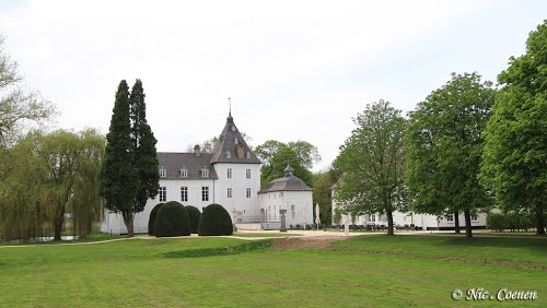
Foto's van Oost-Maarland




Het weer in Oost-Maarland
Lokale tijd: 08:03 PM
Zonsopgang: 07:49 AM
Zonsondergang: 04:53 PM
Sint Anthonie- Polder, Nederland
Breedtegraad: 51.7978 // Lengtegraad: 4.53144
Foto's van Sint Anthonie- Polder


Het weer in Sint Anthonie- Polder
Lokale tijd: 08:03 PM
Zonsopgang: 07:57 AM
Zonsondergang: 04:55 PM


